Key Points
- Permanent Home Established: The General Bathymetric Chart of the Oceans (GEBCO) has officially opened its first permanent Secretariat in Monaco to serve as a central coordinating body for global ocean floor mapping efforts.
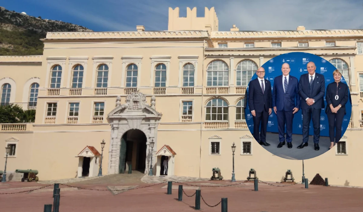
- Royal Inauguration: H.S.H. Prince Albert II of Monaco led the inauguration ceremony on 13 October 2026 alongside key international officials and members of the International Hydrographic Organization (IHO) Council.
- Funding & Leadership: The Government of Monaco is fully funding the Secretariat’s operation for its initial three-year period, with Sam Harper, Assistant Director at the IHO, appointed as Head of the GEBCO Secretariat.
- Significant Data Gap: Over 70% of the Earth’s ocean floor remains unmapped to modern standards, despite seabed depth data being crucial for science, navigation, tsunami early warnings, and the marine economy.
- Joint Governance: GEBCO operates as a joint initiative between the IHO and the Intergovernmental Oceanographic Commission (IOC) of UNESCO, continuing a scientific legacy started in 1903 by Prince Albert I of Monaco.
MONACO (Monaco Weekly News) October 19, 2026 – The global initiative dedicated to mapping the entirety of the world’s ocean floor has established a permanent administrative headquarters in the Principality of Monaco. The General Bathymetric Chart of the Oceans (GEBCO) officially opened its new Secretariat during a formal inauguration ceremony held on 13 October 2026, led by His Serene Highness Prince Albert II of Monaco and senior international oceanographic representatives. Hosted within the existing offices of the International Hydrographic Organization (IHO), the newly established entity will provide a dedicated operational framework to streamline global seabed survey activities and foster international scientific collaboration.
- Key Points
- What Is the Significance of Establishing the New GEBCO Secretariat in Monaco?
- Why Is Seabed Mapping Considered a Cornerstone of the Ocean Economy?
- What Are the Strategic Objectives and Priorities of the New Secretariat?
- Background of the GEBCO Programme and Monaco’s Historic Role
- How This Development Will Affect Ocean Researchers and Maritime Sectors
What Is the Significance of Establishing the New GEBCO Secretariat in Monaco?
As reported by the primary communications release from the International Hydrographic Organization (IHO), the opening of the General Bathymetric Chart of the Oceans (GEBCO) Secretariat on 13 October 2026 marks a structural transition for global marine cartography. The newly established Secretariat provides the long-standing programme with a dedicated administrative team stationed inside the IHO headquarters in Monaco. According to officials present at the inauguration, the central body has been specifically tasked with managing GEBCO’s expanding portfolio of field operations, institutional partnerships, and long-term strategic projects aimed at comprehensive bathymetric mapping.
The inauguration ceremony was attended by high-level dignitaries, including H.S.H. Prince Albert II of Monaco, Isabelle Berro-Amadeï, Monaco’s Government Counsellor and Minister for Foreign Affairs and Cooperation, and Vidar Helgesen, Executive Secretary of the Intergovernmental Oceanographic Commission (IOC) of UNESCO. They were joined by IHO Director Adam Greenland, IHO Director Dr John Nyberg, and IHO Secretary-General Rear Admiral Luigi Sinapi.
Highlighting the historic technical context behind the development, Rear Admiral Luigi Sinapi stated: “For the first time in history, we have the technology necessary to achieve the goal of a fully known ocean. The creation of the GEBCO Secretariat will give us the means and the people to achieve this ambition.”
To secure the operational foundation of the new administrative hub, the Government of Monaco has committed to funding the Secretariat for its initial three years of operation. Furthermore, Sam Harper, Assistant Director at the IHO, has officially stepped into the role of Head of the GEBCO Secretariat to direct its day-to-day coordination and strategic initiatives.
Why Is Seabed Mapping Considered a Cornerstone of the Ocean Economy?
As detailed by the OECD in its recent policy brief on mapping ocean depths, knowledge of the seafloor’s topography acts as a vital foundation for the broader global blue economy. Bathymetric data—the detailed measurement of water depth and underwater terrain—is required across numerous maritime sectors. Accurate depth readings are essential for safe commercial maritime navigation, oceanographic and climate research, marine spatial planning, sustainable resource exploitation, and offshore renewable energy infrastructure.
Moreover, seafloor mapping plays an urgent role in natural disaster mitigation. Modern tsunami early-warning systems depend heavily on precise bathymetric models to accurately predict wave propagation speed, energy direction, and coastal inundation risks.
Despite the economic and safety imperatives, a vast majority of the seabed remains uncharted to modern scientific standards. Official IHO and GEBCO statistics confirm that more than 70% of the world’s ocean floor has yet to be mapped using contemporary hydrographic technology. The newly launched Secretariat has been explicitly charged with driving international projects to close this gap by facilitating data-sharing agreements, standardising survey methods, and expanding multi-national surveying initiatives.
During the inauguration, Vidar Helgesen, Executive Secretary of IOC-UNESCO, emphasised the dynamic nature of marine science and the institutional shift represented by the new office: “The ocean is a symbol of eternity, yet it remains a constant source of novelty. New findings continue to emerge, while the ocean itself is always changing and regenerating. The new GEBCO Secretariat represents a new phase in ocean exploration, one marked by greater ambition, stronger institutional collaboration, and deeper connection with the global ocean community. This will enable us to better understand and monitor these ongoing changes.”
What Are the Strategic Objectives and Priorities of the New Secretariat?
According to statements released by the IHO, the newly launched Secretariat has established a clear list of immediate operational priorities aimed at advancing GEBCO’s overarching mission to “bring knowledge about our planet’s seabed to everyone.”
The core objectives outlined for the Secretariat include:
- Expanding Global Initiatives: Coordinating multi-vessel survey workflows and integrating data collected from private, scientific, and governmental fleets into unified open-access bathymetric grids.
- Policy and Data Governance: Shaping an international policy environment that reduces bureaucratic barriers to seabed mapping and actively encourages countries and commercial operators to share existing hydrographic data.
- Financial Partnerships: Building robust public-private funding models and securing long-term capital investments to finance mapping expeditions in remote or high-seas regions.
- Institutional Coordination: Servicing the operational needs of the joint governance framework run by the IHO and IOC-UNESCO.
In his closing remarks at the ceremony, Rear Admiral Luigi Sinapi expressed his vision for the headquarters’ role on the world stage, stating his “ambition that this Secretariat becomes a beacon of international cooperation, scientific excellence and shared ambition; that Monaco continues to be the place where the world’s commitment to ocean knowledge finds both its inspiration and its direction.” He added that “the future of our oceans is inseparable from the future of humanity.”
Background of the GEBCO Programme and Monaco’s Historic Role
The establishment of the Secretariat in Monaco continues a scientific lineage that spans over a century. The General Bathymetric Chart of the Oceans initiative was originally conceived by Prince Albert I of Monaco (1848–1922), a pioneering oceanographer, navigator, and scientist who recognized the severe lack of accurate bathymetric information available to the global scientific community.
In 1903, under the direct sponsorship and scientific leadership of Prince Albert I, the very first edition of the GEBCO charts was published. These initial charts relied primarily on lead-line depth soundings painstakingly collected during Prince Albert I’s own oceanographic expeditions across the Atlantic Ocean and Mediterranean Sea.
Over the course of the 20th century, modern survey technologies evolved from single-beam echo sounders to advanced multibeam sonar systems and satellite altimetry. As hydrographic science modernized and required wider international standardization, GEBCO evolved into a joint programme operated jointly by the International Hydrographic Organization (IHO) and the Intergovernmental Oceanographic Commission (IOC) of UNESCO. Today, GEBCO relies on a worldwide network of hydrographers, oceanographers, and technical experts who collect, manage, and synthesize depth measurements into publicly available gridded bathymetric datasets.
How This Development Will Affect Ocean Researchers and Maritime Sectors
The creation of a centralized, permanently funded GEBCO Secretariat in Monaco is expected to produce direct operational benefits for several key global groups:
- Oceanographic and Climate Researchers: Scientists studying deep-ocean currents, heat distribution, and marine ecosystems will gain faster access to standardized, high-resolution bathymetric models. Improved seafloor charts allow researchers to produce significantly more accurate climate prediction models and track benthic biodiversity with higher precision.
- Commercial Maritime and Coastal Infrastructure Sectors: Offshore energy developers, telecommunication companies laying subsea fiber-optic cables, and commercial shipping fleets will benefit from reduced logistical risks and lowered survey overheads through improved access to public seabed data.
- Coastal Communities and Disaster Risk Managers: Communities vulnerable to coastal hazards such as tsunamis and storm surges will see improved safety frameworks as coastal hazard modellers gain access to accurate nearshore and deep-water bathymetry, enabling precise early warnings and coastal defense planning.
- Intergovernmental Policy Makers: The Secretariat’s dedicated policy focus will assist national hydrographic offices in establishing standardized data-sharing protocols, leading to more cohesive international marine spatial planning and sovereign ocean management.